Log in
All resources
Create a design
186 Free Artworks of 18th Century Maps Of Amsterdam
maps in the rijksmuseum amsterdam
gerard valck
prints of cartouches in the rijksmuseum amsterdam
17th-century celestial maps
maps by gerard valck
18th-century celestial maps
prints published by pieter schenk (i)
prints by jan luyken in the rijksmuseum amsterdam
les forces de l'europe, asie, afrique et amerique, ou description des principales villes, avec leurs fortifications
dutch 18th-century prints in the rijksmuseum amsterdam
maps in the rijksmuseum amsterdam
old maps of algeria
prints by caspar luyken in the rijksmuseum amsterdam
engravings of birds in the rijksmuseum amsterdam
prints of cartouches in the rijksmuseum amsterdam
maps in the rijksmuseum amsterdam
maps in the rijksmuseum amsterdam
17th-century celestial maps
maps in the rijksmuseum amsterdam
17th-century celestial maps
maps in the rijksmuseum amsterdam
17th-century celestial maps
maps in the rijksmuseum amsterdam
17th-century celestial maps
johann peter feuerlein
pieter schenk (i)
maps in the rijksmuseum amsterdam
18th-century maps of venice
les forces de l'europe, asie, afrique et amerique, ou description des principales villes, avec leurs fortifications
maps of the history of poitou
maps in the rijksmuseum amsterdam
old maps of tholen
maps in the rijksmuseum amsterdam
18th-century maps of antwerp
prints of cartouches in the rijksmuseum amsterdam
maps in the rijksmuseum amsterdam
prints by jan luyken in the rijksmuseum amsterdam
maps in the rijksmuseum amsterdam
maps in the rijksmuseum amsterdam
17th-century celestial maps
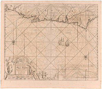
cádiz in the 18th century
old maps of cádiz
jacob van schuppen
baroque
maps in the rijksmuseum amsterdam
17th-century celestial maps
maps in the rijksmuseum amsterdam
17th-century celestial maps
maps in the rijksmuseum amsterdam
17th-century celestial maps
maps in the rijksmuseum amsterdam
17th-century celestial maps
maps in the rijksmuseum amsterdam
17th-century celestial maps
maps in the rijksmuseum amsterdam
17th-century celestial maps
prints of cartouches in the rijksmuseum amsterdam
maps in the rijksmuseum amsterdam
old maps of stavanger
old maps of rogaland
prints of cartouches in the rijksmuseum amsterdam
maps in the rijksmuseum amsterdam
maps in the rijksmuseum amsterdam
18th-century maps of rome
maps in the rijksmuseum amsterdam
17th-century celestial maps
maps in the rijksmuseum amsterdam
17th-century celestial maps
maps in the rijksmuseum amsterdam
17th-century celestial maps
prints by jan luyken in the rijksmuseum amsterdam
maps in the rijksmuseum amsterdam
watercolor paintings in the rijksmuseum amsterdam
maps in the rijksmuseum amsterdam
cádiz in the 18th century
old maps of cádiz
old maps of møre og romsdal
stadlandet
maps in the rijksmuseum amsterdam
17th-century celestial maps
maps in the rijksmuseum amsterdam
17th-century celestial maps
maps in the rijksmuseum amsterdam
17th-century celestial maps
maps in the rijksmuseum amsterdam
17th-century celestial maps
maps in the rijksmuseum amsterdam
17th-century celestial maps
maps in the rijksmuseum amsterdam
17th-century celestial maps
maps in the rijksmuseum amsterdam
17th-century celestial maps
maps in the rijksmuseum amsterdam
18th-century maps of indonesia
maps in the rijksmuseum amsterdam
gerard valck
prints by jan luyken in the rijksmuseum amsterdam
maps in the rijksmuseum amsterdam
maps in the rijksmuseum amsterdam
caartboeck van voorne, 1701
maps in the rijksmuseum amsterdam
david coster
cádiz in the 18th century
old maps of cádiz
dutch 18th-century prints in the rijksmuseum amsterdam
old maps of roermond
etchings in the rijksmuseum amsterdam
18th-century maps of catalonia
prints by jan luyken in the rijksmuseum amsterdam
maps in the rijksmuseum amsterdam
prints by jan luyken in the rijksmuseum amsterdam
maps in the rijksmuseum amsterdam
cádiz in the 18th century
old maps of cádiz
prints by jan luyken in the rijksmuseum amsterdam
maps in the rijksmuseum amsterdam
prints by jan luyken in the rijksmuseum amsterdam
maps in the rijksmuseum amsterdam
prints by jan luyken in the rijksmuseum amsterdam
maps in the rijksmuseum amsterdam
prints by jan luyken in the rijksmuseum amsterdam
maps in the rijksmuseum amsterdam
maps of texel
caspar specht
dutch 18th-century drawings in the rijksmuseum amsterdam
gerrit de broen jr. (1692-1774)
works after cornelis pronk
old maps of arnemuiden
maps in the rijksmuseum amsterdam
baroque
american paintings in the rijksmuseum amsterdam
portraits by john greenwood
les forces de l'europe, asie, afrique et amerique, ou description des principales villes, avec leurs fortifications
portolan charts made in the 18th century
les forces de l'europe, asie, afrique et amerique, ou description des principales villes, avec leurs fortifications
portolan charts made in the 18th century
maps in the rijksmuseum amsterdam
nicolaas listingh
maps in the rijksmuseum amsterdam
neoclassicism
les forces de l'europe, asie, afrique et amerique, ou description des principales villes, avec leurs fortifications
18th-century maps of grenoble
les forces de l'europe, asie, afrique et amerique, ou description des principales villes, avec leurs fortifications
madrid in the 1700s
maps in the rijksmuseum amsterdam
18th-century maps of rome
les forces de l'europe, asie, afrique et amerique, ou description des principales villes, avec leurs fortifications
old maps of cádiz
de nieuwe groote lichtende zee-fakkel (rijksmuseum)
prints by jan luyken in the rijksmuseum amsterdam
les forces de l'europe, asie, afrique et amerique, ou description des principales villes, avec leurs fortifications
portolan charts made in the 18th century
les forces de l'europe, asie, afrique et amerique, ou description des principales villes, avec leurs fortifications
portolan charts made in the 18th century
les forces de l'europe, asie, afrique et amerique, ou description des principales villes, avec leurs fortifications
portolan charts made in the 18th century
les forces de l'europe, asie, afrique et amerique, ou description des principales villes, avec leurs fortifications
portolan charts made in the 18th century
les forces de l'europe, asie, afrique et amerique, ou description des principales villes, avec leurs fortifications
portolan charts made in the 18th century
les forces de l'europe, asie, afrique et amerique, ou description des principales villes, avec leurs fortifications
portolan charts made in the 18th century
dutch golden age painting
botermarktkerk, amsterdam
dutch golden age painting
botermarktkerk, amsterdam
les forces de l'europe, asie, afrique et amerique, ou description des principales villes, avec leurs fortifications
portolan charts made in the 18th century
dutch golden age painting
botermarktkerk, amsterdam
dutch golden age painting
botermarktkerk, amsterdam
dutch golden age painting
botermarktkerk, amsterdam
les forces de l'europe, asie, afrique et amerique, ou description des principales villes, avec leurs fortifications
vigo in the 18th century
maps in the rijksmuseum amsterdam
david coster
maps in the rijksmuseum amsterdam
david coster
maps in the rijksmuseum amsterdam
david coster
101 - 186 of 186
/ 2